

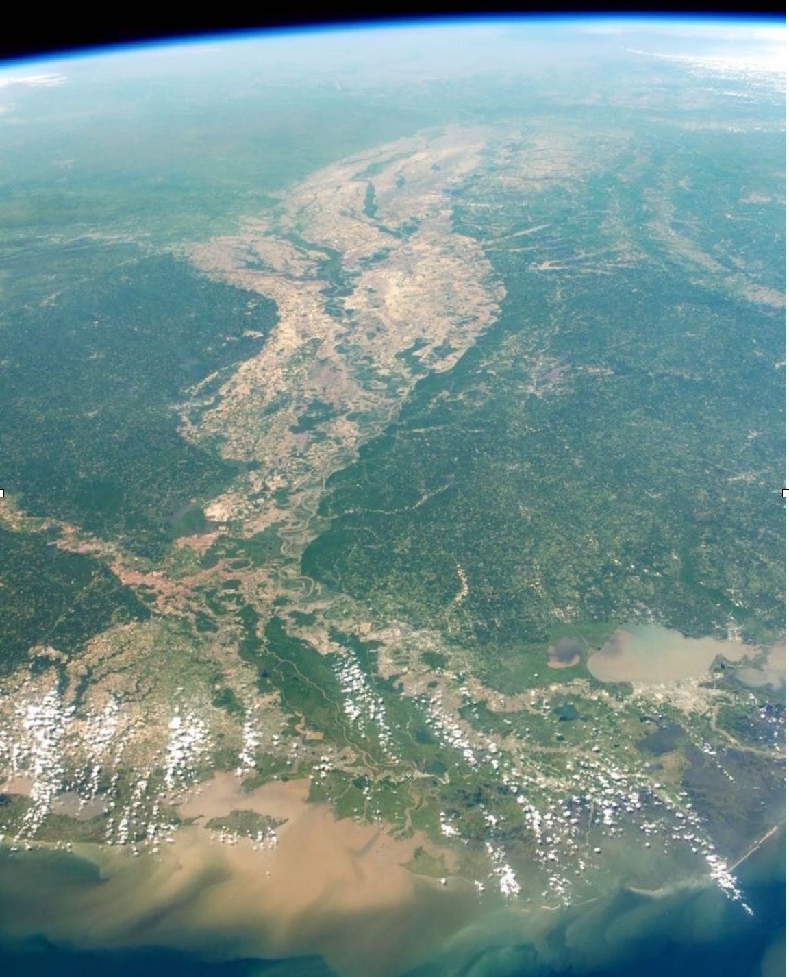
There are few places in the United States as heavily altered as the floodplain of the Mississippi River. This is a place immediately apparent in satellite photographs: while most of the country is a fuzzy swath of greenery, the Mississippi’s floodplain appears in mottled brown. That’s the result of the nearly absolute lack of trees, which were cut down over the past few centuries, mostly for the sake of cotton farms.
Down the center of that brown band, though, notice the slash of green: a stand of forest runs through the continent’s heart. This is what’s known locally as the “batture.”
The farmland along the Mississippi River is protected from floods by a massive levee, a pile of earth that stands three stories tall—more, in places—and stretches for a thousand miles. The batture is, in the words of the inimitable writer John McPhee, “the silt-swept no man's land” that lies between this levee and the river itself.
It’s more th…
Keep reading with a 7-day free trial
Subscribe to southlands to keep reading this post and get 7 days of free access to the full post archives.